

Geography, Demography, and Administration
BATAM IS LOCATED IN THE RIAU ISLANDS PROVINCE (KEPRI)
When you were on the plane earlier, did you see the small islands below?
The administrative area of Batam City consists of 329 large and small islands, separated by waters. Batam City itself is located on Batam Island, which belongs to the Riau Islands Province. Batam is strategically positioned along international shipping routes, making it one of the fastest-growing cities in Indonesia.
Batam is also located very close to Singapore and Malaysia, further contributing to its rapid development. The city covers a land area of 715 km², while the total area including water reaches 1,575 km².
The city’s motto is “Banda Dunia Madani” (A Civilized World Port) and its establishment was based on Law No. 53 of 1999.
The organizational structure and administrative system of the Batam City Government are regulated by local regulations, including Regional Regulation No. 8 of 2007 (dated October 15, 2003) concerning the organizational structure of the Regional Secretariat and the Regional House of Representatives Secretariat.
The Riau Islands Province consists of five regencies (Natuna, Anambas, Lingga, Karimun, and Bintan) and two cities (Batam and Tanjung Pinang). Tanjung Pinang is the provincial capital.
The word “Riau” comes from “Riuh”, meaning crowded or lively, reflecting its past as a bustling trade hub. Similarly, “Pekanbaru” derives from “Pekan”, meaning market. By ferry, Tanjung Pinang is about one hour from Batam.
The province is also known by the nickname “Si Gantang Lada” (A Basket of Pepper). Legend says that when the Sultan of Riau-Lingga tried to count the many islands in his territory, he used pepper seeds and buckets to represent each island they passed by ship.
Batam’s strategic location near Singapore and Malaysia makes it a transit hub for travelers and tourists. It ranks as Indonesia’s third most-visited international entry point, after Bali and Jakarta.
Batam, as one of Indonesia’s international tourism gateways, offers a wide variety of tourism experiences under nine themes:
- Religious tourism
- Sports tourism
- Agro and eco-tourism
- Culinary tourism
- Shopping tourism
- MICE (Meetings, Incentives, Conferences, and Exhibitions) tourism
- Marine tourism
- Cultural tourism
- Historical tourism
DEMOGRAPHY
As you can see on the right and left sides, Batam’s traffic is not too congested. According to the 2020 Population Census by the Batam City Statistics Agency (BPS), the population of Batam is approximately 1.196 million people.
HISTORY OF BATAM CITY
The Name “Batam”
Has anyone here ever visited Batam before? Then you might already know the playful acronyms people use for its name.
Some people also believe “Batam” is short for “Batu Ampar”, taken from the name of one of Batam’s districts.
Folklore: The Legend of Batu Ampar
Long ago, there was a princess from Temasek (modern-day Singapore). One day, a man from India arrived, bringing ten chests of gold, and challenged the princess: if someone from Temasek could lift a giant stone across the sea within seven days, the gold would be theirs. Otherwise, he would attack the kingdom.
On the seventh day, when everyone had lost hope, a frail, limping adventurer named Badang stepped forward. To everyone’s surprise, he lifted the stone and threw it across the sea it landed on an island now known as Batam, in the area called Batu Ampar.
Early References to “Batam”
The earliest clear mention of Batam is found in the London Treaty of 1824.
In 1898, a brick factory was established on land owned by Raja Ali Kelana, in collaboration with Ong Sam Leong, an entrepreneur from Singapore. The factory was called Batam Brickworks, and its equipment was imported from Germany, producing high-quality bricks.
The factory gained fame through advertisements in Singapore and even won a Bronze Medal at industrial exhibitions in Hanoi and Penang before collapsing in 1910. Each brick bore the inscription “BATAM”, which helped popularize the island’s name.
The Sea and Forest Tribes
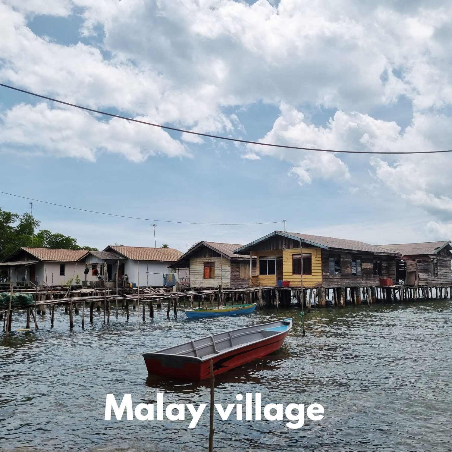
Before Batam’s official development, it was home to the Sea Tribe (Orang Laut) and Forest Tribe (Orang Darat).
The Sea Tribe lived on small boats roofed with palm leaves, floating among the Riau Islands. Each boat housed one family, and their daily life revolved around fishing. They would occasionally come ashore to trade or hold weddings.
A unique wedding tradition among them involved a boat-paddling competition between the bride and groom — usually won by the groom, symbolizing his role as the family provider.
In 1988, the government implemented the PKAT program, resettling the Sea Tribe on land in Bertam Island, Belakang Padang, providing housing, transportation, schools, and mosques.
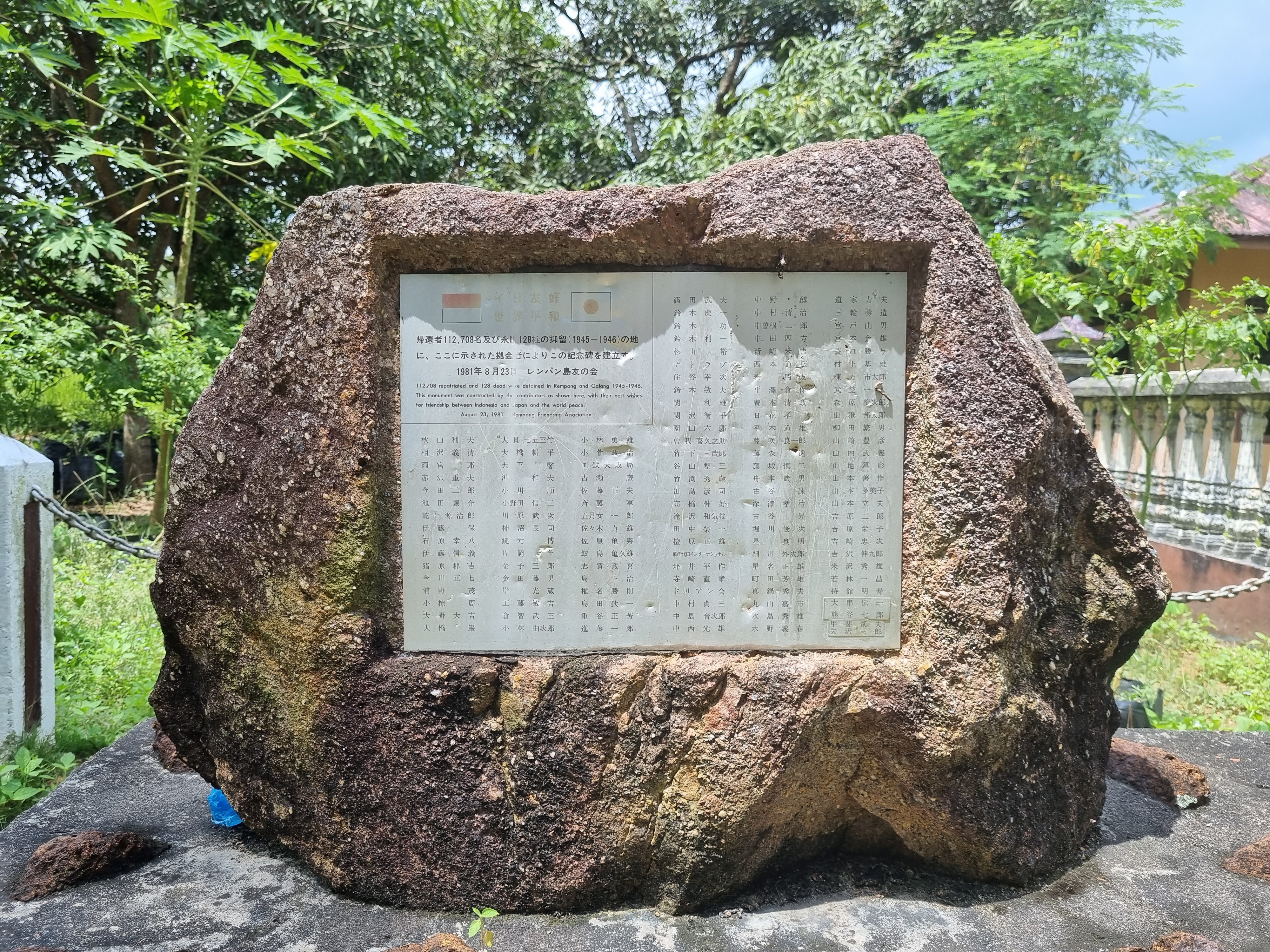
The Forest Tribe, or Orang Darat, mainly lived on Rempang and Galang Islands, dwelling under large trees with simple shelters and relying on farming. Over time, they assimilated with migrants, and their numbers declined.
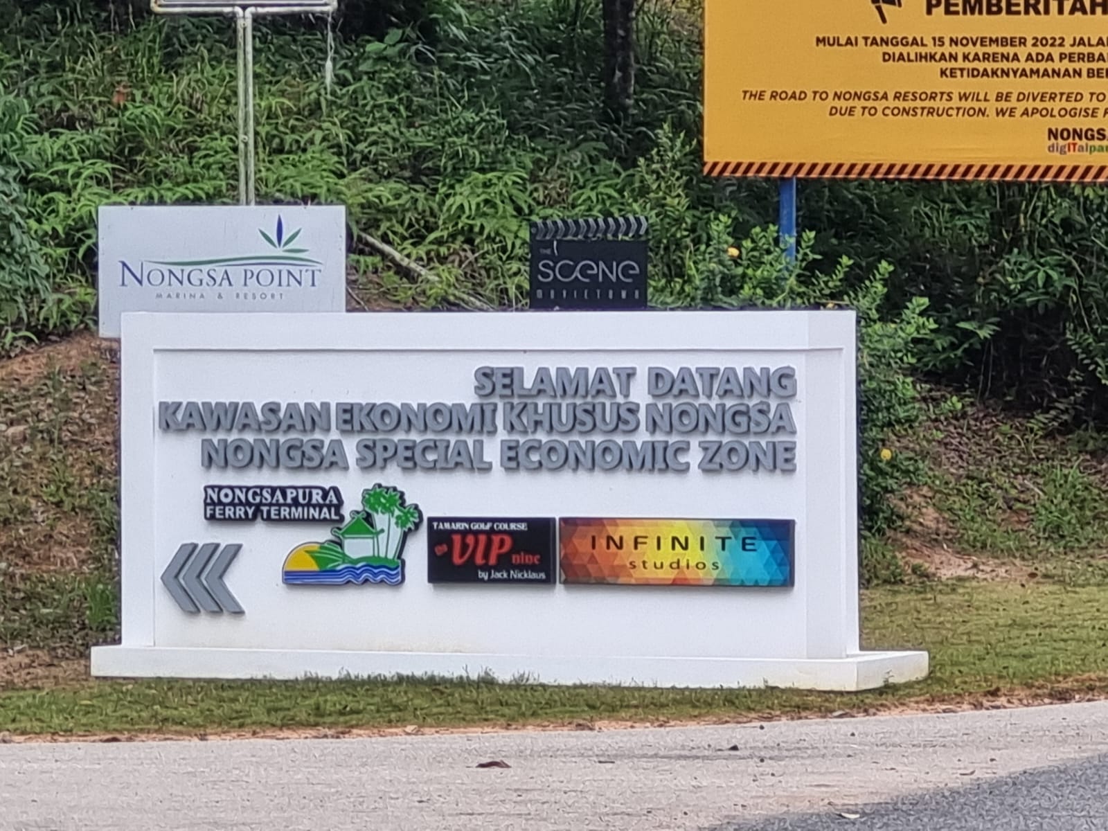
Nongsa: The Cradle of Batam’s Administration
Batam’s early administration began in Nongsa, named after Raja Isa (Nong Isa), a delegate of the Riau-Lingga Sultanate. He was officially mandated to govern Batam on December 18, 1828, a date now commemorated as Batam’s founding day.
Nongsa is home to Batu Besar Village, where Hang Nadim International Airport is now located. The name “Batu Besar” (“big rock”) refers to a large rock near the shore marking the end of a coral reef.
Originally settled in the late 19th century by M. Akib from Malacca, the village became home to Malay, Bugis, and Chinese settlers. It was once known as Labong Gorap, after a type of small clam found on its beach.
In 1947, Batu Besar became a key producer of copra, exporting it to Singapore, and by 1957, it hosted the first school in Batam.
Today, Nongsa has evolved into a resort and golf area, with Nongsa D-Town serving as a film production site managed by Kinema Studios. Fun fact: the Garfield cartoon and the Iko Uwais film Beyond Skyline were both produced there.
Early Batam Authority (Otorita Batam)
In the 1950s–1960s, Batam’s population reached about 6,000. In 1969, Pertamina began developing Batam as an offshore oil logistics base, relocated from Singapore due to lower costs.
Under Presidential Decree No. 65 of 1970, President Soeharto designated Batam as a logistics and operations base for offshore oil. Later, Presidential Decree No. 74 of 1971 declared Batam an industrial area.
This marked the establishment of Otorita Batam, led first by Ibnu Sutowo, then J.B. Sumarlin, and later B.J. Habibie (1978–1998).
Habibie’s era saw the creation of the SIJORI Growth Triangle (Singapore–Johor–Riau), industrial cooperation inspired by Europe’s BENELUX alliance. Singapore brought investors, Malaysia provided markets, and Batam offered land and labor.
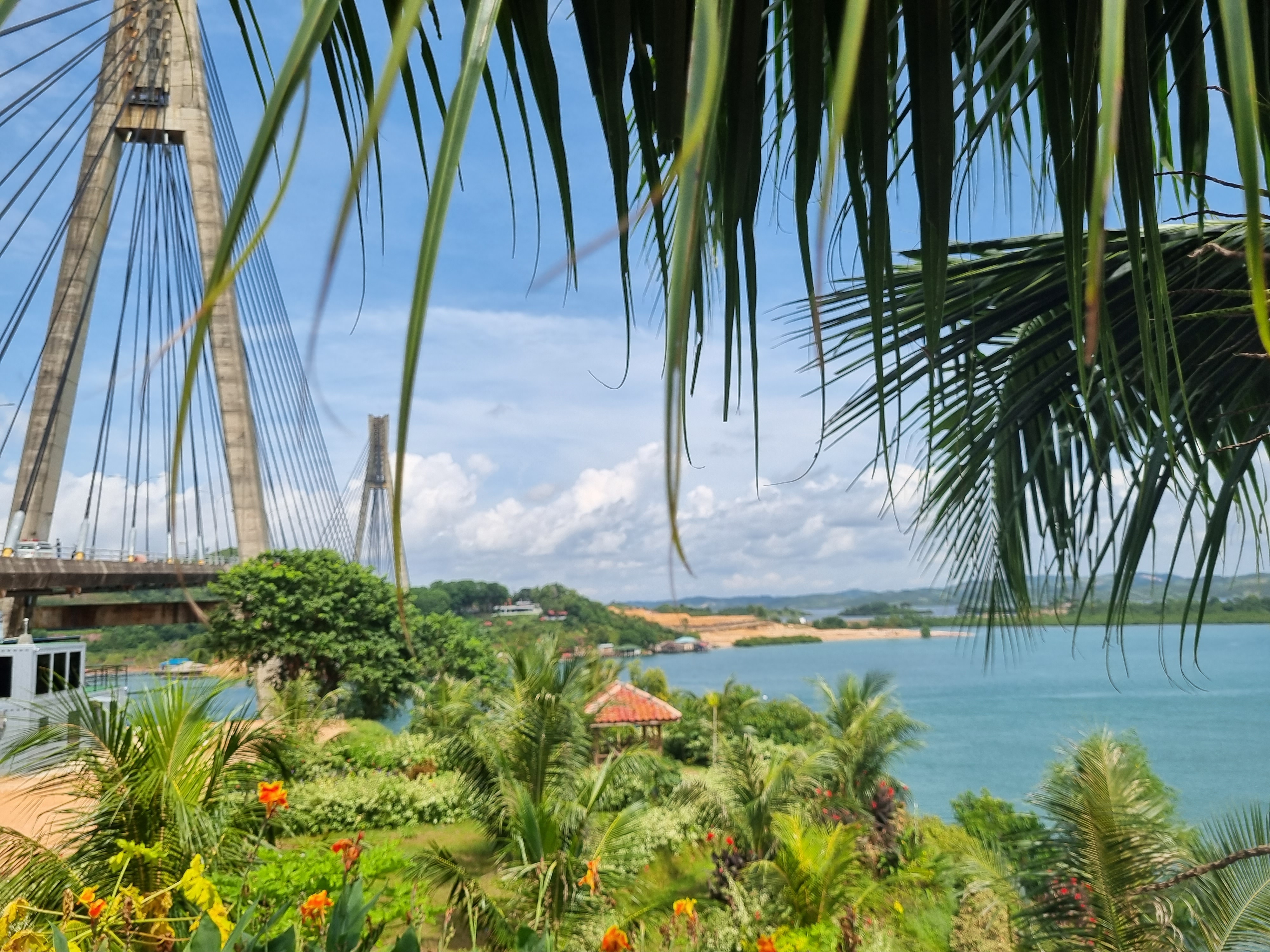
He also initiated construction of the Barelang Bridge (1992–1998) — connecting Batam, Rempang, and Galang Islands — a landmark symbolizing regional connectivity.
Batam land ownership follows a leasehold system under the Batam Authority’s Land Management Rights (HPL). Residents receive Building Use Rights (HGB) instead of full land titles, paying annual dues called UWTO, which fund infrastructure development.
Batam’s Industrial Development
Batam hosts 49 industrial zones, with Batamindo Industrial Park (Muka Kuning) being the largest, spanning 1,000 hectares and housing major companies such as Epson, Sony, Philips, and Schneider.
Most industries are export-oriented, producing electronics, plastics, and ship components. Major sectors include:
- Light industries (electronics assembly, cables, plastics)
- Heavy industries (shipbuilding, offshore rigs, fabrication)
In the 1970s, Batam’s population was only 6,000, but by 1998 it had surged to 264,470 due to rapid industrialization.
